Geolocate

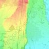
Bogogno topographic map

Click on the map to display elevation.

About this map

Name: Bogogno topographic map, elevation, terrain.

Location: Bogogno, Novara, Piemonte, Italia (45.64462 8.51638 45.68036 8.55925)

Average elevation: 299 m

Minimum elevation: 261 m

Maximum elevation: 343 m

Other topographic maps

Click on a map to view its topography, its elevation and its terrain.

Coiromonte

Italia > Piemonte > Novara

Average elevation: 739 m

Fosseno

Italia > Piemonte > Novara

Average elevation: 548 m

Gaggiolo

Italia > Piemonte > Novara

Average elevation: 211 m

Tabarino

Italia > Piemonte > Novara

Average elevation: 555 m

Gear up for your next adventure:

🔋Lithium AA Batteries - Long-lasting power that performs in extreme cold
🧤Insulated Winter Gloves - Heavy-duty protection for sub-zero Canadian adventures
🛶Kayak Accessories - Essential gear for safe and fun kayaking adventures
💡LED Camping Lantern - Illuminate your campsite with long-lasting lanterns
🐕Hiking Dog Pack - Let your canine companion carry their own water and food

As an Amazon Associate, this site earns from qualifying purchases at no extra cost to you.