Geolocate

Bettange topographic map

Click on the map to display elevation.

About this map
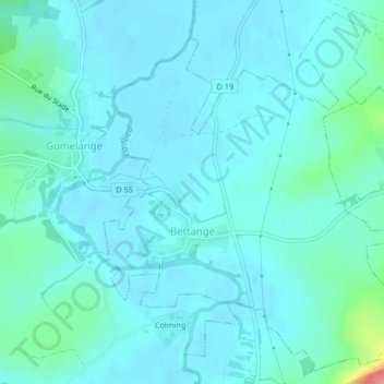
Name: Bettange topographic map, elevation, terrain.

Location: Bettange, Forbach-Boulay-Moselle, Moselle, Grand Est, Metropolitan France, 57220, France (49.22707 6.47222 49.25235 6.50795)

Average elevation: 209 m

Minimum elevation: 197 m

Maximum elevation: 289 m

Other topographic maps

Click on a map to view its topography, its elevation and its terrain.

Entrange Cité

France > Grand Est > Moselle

Average elevation: 237 m

Gear up for your next adventure:

🦶Anti-Blister Balm - Prevents friction and hotspots during long ascents
🚲Heavy Duty Bike Lock - Secure your bike at the trailhead or during stops
💧Hydration Pack - Hands-free hydration system for long hikes
⛺Camping Groundsheet - Protect your tent from moisture and dirt
❄️Traction Ice Cleats - Slip-on spikes for icy trails and winter hiking

As an Amazon Associate, this site earns from qualifying purchases at no extra cost to you.