
Thiviers topographic map
Click on the map to display elevation.
About this map
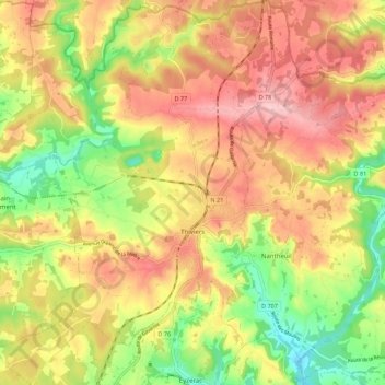
Name: Thiviers topographic map, elevation, terrain.
Average elevation: 235 m
Minimum elevation: 140 m
Maximum elevation: 316 m
Other topographic maps
Click on a map to view its topography, its elevation and its terrain.
Laudibertie
France > Nouvelle-Aquitaine > Dordogne > Saint-Privat-en-Périgord > Festalemps
Average elevation: 93 m
La Fageole
France > Nouvelle-Aquitaine > Dordogne > Saint-Félix-de-Reillac-et-Mortemart
Average elevation: 213 m