
Thank you for supporting this site ❤️
Make a donation
Make a donation
Gear up for your next adventure:
As an Amazon Associate, this site earns from qualifying purchases at no extra cost to you.
窑沟村 topographic map
Click on the map to display elevation.
Thank you for supporting this site ❤️
Make a donation
Make a donation
Gear up for your next adventure:
As an Amazon Associate, this site earns from qualifying purchases at no extra cost to you.
About this map
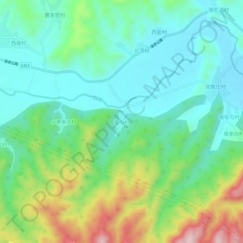
Name: 窑沟村 topographic map, elevation, terrain.
Location: 窑沟村, Zhangjiakou, Hebei, China (40.65686 116.07427 40.69686 116.11427)
Average elevation: 706 m
Minimum elevation: 611 m
Maximum elevation: 939 m
Thank you for supporting this site ❤️
Make a donation
Make a donation
Gear up for your next adventure:
As an Amazon Associate, this site earns from qualifying purchases at no extra cost to you.