
Thank you for supporting this site ❤️
Make a donation
Make a donation
Gear up for your next adventure:
As an Amazon Associate, this site earns from qualifying purchases at no extra cost to you.
Chefchaouen topographic map
Click on the map to display elevation.
Thank you for supporting this site ❤️
Make a donation
Make a donation
Gear up for your next adventure:
As an Amazon Associate, this site earns from qualifying purchases at no extra cost to you.
About this map
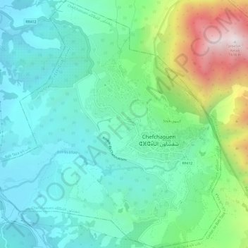
Name: Chefchaouen topographic map, elevation, terrain.
Location: Chefchaouen, Chefchaouen Province, Morocco (35.14755 -5.30772 35.19623 -5.25350)
Average elevation: 619 m
Minimum elevation: 279 m
Maximum elevation: 1,600 m
Thank you for supporting this site ❤️
Make a donation
Make a donation
Gear up for your next adventure:
As an Amazon Associate, this site earns from qualifying purchases at no extra cost to you.