
Make a donation
Gear up for your next adventure:
As an Amazon Associate, this site earns from qualifying purchases at no extra cost to you.
Monte Renoso topographic map
Click on the map to display elevation.
Make a donation
Gear up for your next adventure:
As an Amazon Associate, this site earns from qualifying purchases at no extra cost to you.
Monte Renoso
Le Monte Renoso (en corse Monti Rinosu) est le plus haut sommet du massif du même nom occupant la région entre les cols de Vizzavona et de Verde. Culminant à 2 352 mètres d'altitude, il est situé sur les communes de Bastelica, Bocognano et Ghisoni.
Make a donation
Gear up for your next adventure:
As an Amazon Associate, this site earns from qualifying purchases at no extra cost to you.
About this map
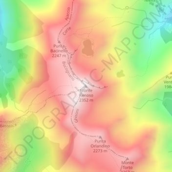
Name: Monte Renoso topographic map, elevation, terrain.
Average elevation: 1,977 m
Minimum elevation: 1,478 m
Maximum elevation: 2,339 m
Make a donation
Gear up for your next adventure:
As an Amazon Associate, this site earns from qualifying purchases at no extra cost to you.