Geolocate

Vilcabamba topographic map

Click on the map to display elevation.

About this map

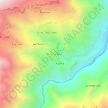
Name: Vilcabamba topographic map, elevation, terrain.

Location: Vilcabamba, Chilcayoc, Sucre, Ayacucho, Perú (-13.92075 -73.73965 -13.88075 -73.69965)

Average elevation: 2,996 m

Minimum elevation: 2,360 m

Maximum elevation: 3,797 m

Gear up for your next adventure:

🥾Trail Hiking Boots - Supportive boots for rough trails
🧥Waterproof Jacket - Lightweight rain jackets for hiking and outdoor activities
🥾Approach Boots - Comfortable boots for hiking and climbing approaches
🧭Orienteering Kit - Tools for map reading and navigation in the wild
🛰️Satellite Messenger - Emergency communication for areas with no cell service

As an Amazon Associate, this site earns from qualifying purchases at no extra cost to you.