
Thank you for supporting this site ❤️
Make a donation
Make a donation
Gear up for your next adventure:
As an Amazon Associate, this site earns from qualifying purchases at no extra cost to you.
Belvedere topographic map
Click on the map to display elevation.
Thank you for supporting this site ❤️
Make a donation
Make a donation
Gear up for your next adventure:
As an Amazon Associate, this site earns from qualifying purchases at no extra cost to you.
About this map
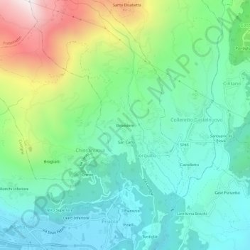
Name: Belvedere topographic map, elevation, terrain.
Location: Belvedere, Borgiallo, Turin, Piedmont, 10082, Italy (45.40184 7.64374 45.44184 7.68374)
Average elevation: 733 m
Minimum elevation: 392 m
Maximum elevation: 1,581 m
Thank you for supporting this site ❤️
Make a donation
Make a donation
Gear up for your next adventure:
As an Amazon Associate, this site earns from qualifying purchases at no extra cost to you.