
Thank you for supporting this site ❤️
Make a donation
Make a donation
Gear up for your next adventure:
As an Amazon Associate, this site earns from qualifying purchases at no extra cost to you.
Geraldine topographic map
Click on the map to display elevation.
Thank you for supporting this site ❤️
Make a donation
Make a donation
Gear up for your next adventure:
As an Amazon Associate, this site earns from qualifying purchases at no extra cost to you.
About this map
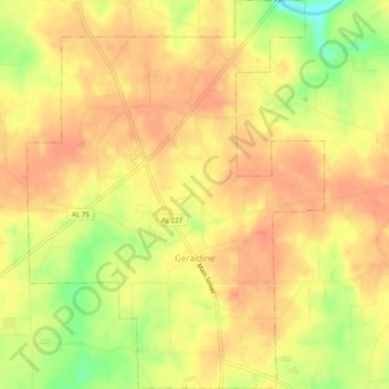
Name: Geraldine topographic map, elevation, terrain.
Location: Geraldine, DeKalb County, Alabama, 35974, United States (34.33788 -86.02197 34.37828 -85.98448)
Average elevation: 349 m
Minimum elevation: 311 m
Maximum elevation: 367 m
Thank you for supporting this site ❤️
Make a donation
Make a donation
Gear up for your next adventure:
As an Amazon Associate, this site earns from qualifying purchases at no extra cost to you.