
Make a donation
Gear up for your next adventure:
As an Amazon Associate, this site earns from qualifying purchases at no extra cost to you.
Gaines topographic map
Click on the map to display elevation.
Make a donation
Gear up for your next adventure:
As an Amazon Associate, this site earns from qualifying purchases at no extra cost to you.
About this map
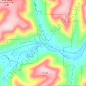
Name: Gaines topographic map, elevation, terrain.
Location: Gaines, Tioga County, Pennsylvania, United States (41.73201 -77.57748 41.77201 -77.53748)
Average elevation: 511 m
Minimum elevation: 363 m
Maximum elevation: 698 m
Make a donation
Gear up for your next adventure:
As an Amazon Associate, this site earns from qualifying purchases at no extra cost to you.
Other topographic maps
Click on a map to view its topography, its elevation and its terrain.
Pine Creek Gorge Natural Area
United States > Pennsylvania > Tioga County > Tiadaghton
Average elevation: 540 m
Make a donation
Gear up for your next adventure:
As an Amazon Associate, this site earns from qualifying purchases at no extra cost to you.