Geolocate

Lawit topographic map

Click on the map to display elevation.

About this map
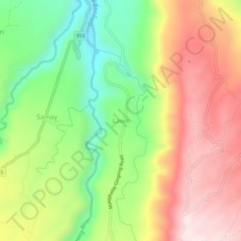
Name: Lawit topographic map, elevation, terrain.

Location: Lawit, Gingoog, Misamis Oriental, Northern Mindanao, Philippines (8.73289 125.09674 8.77289 125.13674)

Average elevation: 373 m

Minimum elevation: 94 m

Maximum elevation: 661 m

Other topographic maps

Click on a map to view its topography, its elevation and its terrain.
Gear up for your next adventure:

⛺Tent Footprint - Protect tent floor and increase durability
🥾Waterproof Hiking Boots - Boots keeping your feet dry in wet conditions
🧤Thermal Hiking Gloves - Grip-enhanced gloves for cold-weather altitude trekking
🕯️Camping Lantern - Illuminates your entire campsite with high-efficiency LEDs
🧥Fleece Jacket - Warm and lightweight jacket for layering

As an Amazon Associate, this site earns from qualifying purchases at no extra cost to you.