Geolocate

Barkot topographic map

Click on the map to display elevation.

About this map

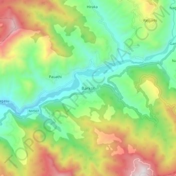
Name: Barkot topographic map, elevation, terrain.

Location: Barkot, Rajgarhi, Uttarkashi district, Uttarakhand, India (30.76861 78.16596 30.84861 78.24596)

Average elevation: 1,628 m

Minimum elevation: 1,096 m

Maximum elevation: 2,540 m

Gear up for your next adventure:

🛌Down Sleeping Bag - Superior warmth-to-weight ratio for cold nights
🧊Insulated Water Bottle - Keeps drinks cold in summer and prevents freezing in winter
🥾Trail Hiking Socks - Comfortable socks to prevent blisters and fatigue
🥾Hiking Boots - Sturdy boots providing ankle support and traction on rugged trails
💧Reusable Water Bottle - Durable water bottles for hydration on trails

As an Amazon Associate, this site earns from qualifying purchases at no extra cost to you.