Geolocate

El Dorado topographic map

Click on the map to display elevation.

About this map

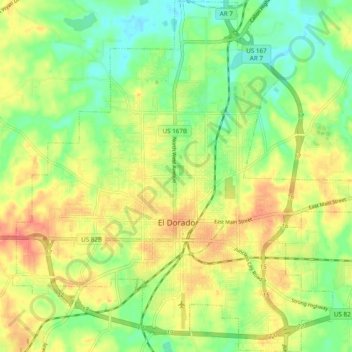
Name: El Dorado topographic map, elevation, terrain.

Location: El Dorado, Union County, Arkansas, United States (33.18186 -92.70991 33.26218 -92.61369)

Average elevation: 66 m

Minimum elevation: 38 m

Maximum elevation: 97 m

Gear up for your next adventure:

🧴Sunscreen SPF - Broad-spectrum sunscreen for outdoor activities
🧦Hiking Liner Socks - Thin base layer to prevent friction and blisters
🧰Survival Kit - Essential gear for emergencies in the wilderness
🧶550 Survival Paracord - Versatile utility cord for emergency repairs and rigging
🥾Approach Boots - Comfortable boots for hiking and climbing approaches

As an Amazon Associate, this site earns from qualifying purchases at no extra cost to you.