Geolocate

Loftahammar topographic map

Click on the map to display elevation.

About this map

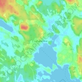
Name: Loftahammar topographic map, elevation, terrain.

Location: Loftahammar, Västerviks kommun, Kalmar County, 590 95, Sweden (57.88435 16.67312 57.92435 16.71312)

Average elevation: 13 m

Minimum elevation: -2 m

Maximum elevation: 46 m

Other topographic maps

Click on a map to view its topography, its elevation and its terrain.

Emmaboda kommun

Sweden > Kalmar County

Average elevation: 141 m

Hansa City

Sweden > Kalmar County

Average elevation: 7 m

Högsby kommun

Sweden > Kalmar County

Average elevation: 97 m

Nybro kommun

Sweden > Kalmar County

Average elevation: 109 m

Hultsfreds kommun

Sweden > Kalmar County

Average elevation: 143 m

Store Hindsjön

Sweden > Kalmar County

Average elevation: 118 m

Mönsterås kommun

Sweden > Kalmar County

Average elevation: 26 m

Alen

Sweden > Kalmar County

Average elevation: 142 m

Emmaboda kommun

Sweden > Kalmar County

Average elevation: 141 m

Oskarshamns kommun

Sweden > Kalmar County

Average elevation: 63 m

Kalmar kommun

Sweden > Kalmar County

Average elevation: 28 m

Gear up for your next adventure:

🥾Trail Hiking Shoes - Durable shoes designed for rugged trails
🧴Sunscreen SPF - Broad-spectrum sunscreen for outdoor activities
🥾Hiking Boots - Sturdy boots providing ankle support and traction on rugged trails
🔦LED Headtorch - Bright and durable light for night activities
🧣Merino Neck Gaiter - Protects against wind, sun, and cold at high altitudes

As an Amazon Associate, this site earns from qualifying purchases at no extra cost to you.