Geolocate

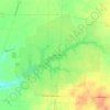
Feesburg topographic map

Click on the map to display elevation.

About this map

Name: Feesburg topographic map, elevation, terrain.

Location: Feesburg, Lewis Township, Brown County, Ohio, 45119, United States (38.85840 -84.01887 38.89840 -83.97887)

Average elevation: 280 m

Minimum elevation: 258 m

Maximum elevation: 302 m

Other topographic maps

Click on a map to view its topography, its elevation and its terrain.

Russellville

United States > Ohio > Brown County

Average elevation: 288 m

Lake Waynoka

United States > Ohio > Brown County

Average elevation: 312 m

Ripley

United States > Ohio > Brown County

Average elevation: 206 m

Georgetown

United States > Ohio > Brown County

Average elevation: 272 m

Sardinia

United States > Ohio > Brown County

Average elevation: 291 m

Pleasant Township

United States > Ohio > Brown County

Average elevation: 260 m

Huntington Township

United States > Ohio > Brown County

Average elevation: 234 m

Russellville

United States > Ohio > Brown County

Average elevation: 288 m

Gear up for your next adventure:

🥾Approach Boots - Comfortable boots for hiking and climbing approaches
🥾Mountaineering Boots - Supportive boots for climbing and high-altitude hiking
🗺️Topographic Maps - Detailed maps to explore trails, mountains, and wilderness areas
🔦LED Headtorch - Bright and durable light for night activities
👟Leg Gaiters - Keep debris, mud, and snow out of your boots

As an Amazon Associate, this site earns from qualifying purchases at no extra cost to you.