Geolocate

Melvindale topographic map

Click on the map to display elevation.

About this map

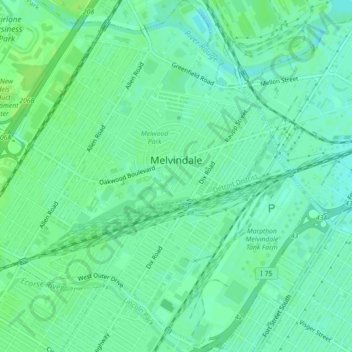
Name: Melvindale topographic map, elevation, terrain.

Location: Melvindale, Wayne County, Michigan, 48122, United States (42.26458 -83.20126 42.29748 -83.15801)

Average elevation: 181 m

Minimum elevation: 175 m

Maximum elevation: 186 m

Other topographic maps

Click on a map to view its topography, its elevation and its terrain.

Perrinville

United States > Michigan > Wayne County > Westland

Average elevation: 195 m

Sunnyside

United States > Michigan > Wayne County > Romulus

Average elevation: 194 m

Calvert Park

United States > Michigan > Wayne County > Detroit

Average elevation: 196 m

Elm

United States > Michigan > Wayne County > Livonia

Average elevation: 195 m

Newburg

United States > Michigan > Wayne County > Livonia

Average elevation: 209 m

Dearborn

United States > Michigan > Wayne County > Dearborn

Average elevation: 190 m

Gear up for your next adventure:

👟Sport Hiking Sandals - Breathable footwear for water crossings and camp rest
🛏️Sleeping Bag - Warm and compact sleeping bags for outdoor camping
🛁Quick-Dry Microfiber Towel - Space-saving towel that dries rapidly on the move
🧥Insulated Jacket - Keep warm in cold outdoor conditions
🧭GPS Tracker - Track your location in remote areas safely

As an Amazon Associate, this site earns from qualifying purchases at no extra cost to you.