Geolocate

Estanza topographic map

Click on the map to display elevation.

About this map
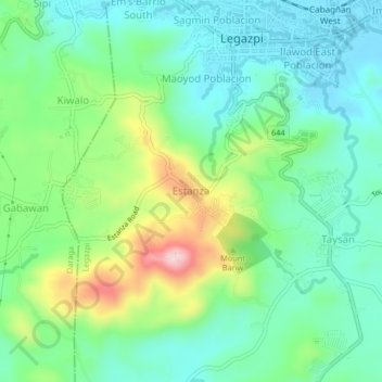
Name: Estanza topographic map, elevation, terrain.

Location: Estanza, Legazpi, Albay, Bicol Region, 4500, Philippines (13.10261 123.70898 13.14261 123.74898)

Average elevation: 81 m

Minimum elevation: 3 m

Maximum elevation: 266 m

Other topographic maps

Click on a map to view its topography, its elevation and its terrain.

Tibu River

Philippines > Albay > Legazpi > Tamaoyan

Average elevation: 4 m

Mayon Volcano

Philippines > Albay > Legazpi

Average elevation: 519 m

Sawangan Park

Philippines > Albay > Legazpi

Average elevation: 7 m

Kalayaan Park

Philippines > Albay > Legazpi

Average elevation: 7 m

Gear up for your next adventure:

⛺Camping Groundsheet - Protect your tent from moisture and dirt
🧭GPS Tracker - Track your location in remote areas safely
👟Sport Hiking Sandals - Breathable footwear for water crossings and camp rest
🔋Lithium AA Batteries - Long-lasting power that performs in extreme cold
🥾Trail Running Boots - Durable shoes designed for trail running

As an Amazon Associate, this site earns from qualifying purchases at no extra cost to you.