Geolocate

Princess Urduja topographic map

Click on the map to display elevation.

About this map
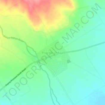
Name: Princess Urduja topographic map, elevation, terrain.

Location: Princess Urduja, Narra, Palawan, Mimaropa, Philippines (9.20977 118.30941 9.24977 118.34941)

Average elevation: 48 m

Minimum elevation: 15 m

Maximum elevation: 111 m

Other topographic maps

Click on a map to view its topography, its elevation and its terrain.

Malatgao River

Philippines > Palawan > Narra

Average elevation: 38 m

Gear up for your next adventure:

🛶Canoe Life Vest - Safety vest for water sports
💡Solar Camping Lamp - Eco-friendly lighting for campsites
🧤Rechargeable Heated Gloves - Extreme warmth for Canadian winter expeditions
🛌Down Sleeping Bag - Superior warmth-to-weight ratio for cold nights
🧥Packable Rain Jacket - Breathable waterproof layer for unpredictable weather

As an Amazon Associate, this site earns from qualifying purchases at no extra cost to you.