Geolocate

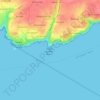
Coscastel topographic map

Click on the map to display elevation.

About this map

Name: Coscastel topographic map, elevation, terrain.

Location: Coscastel, Plouzané, Brest, Finistère, Bretagne, France métropolitaine, 29280, France (48.36481 -4.61963 48.40481 -4.57963)

Average elevation: 65 m

Minimum elevation: 30 m

Maximum elevation: 101 m

Other topographic maps

Click on a map to view its topography, its elevation and its terrain.
Gear up for your next adventure:

🥾Hiking Shoes - Durable and comfortable shoes for trail hiking
🧰Multitool Knife - Compact and versatile tool for outdoor use
🧥Insulated Jacket - Keep warm in cold outdoor conditions
🧭Orienteering Kit - Tools for map reading and navigation in the wild
⛺Lightweight Camping Tent - Portable shelter optimized for Canadian backcountry camping

As an Amazon Associate, this site earns from qualifying purchases at no extra cost to you.