Geolocate

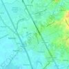
Saog topographic map

Click on the map to display elevation.

About this map

Name: Saog topographic map, elevation, terrain.

Location: Saog, Marilao, Bulacan, Central Luzon, Philippines (14.75509 120.94902 14.76792 120.96325)

Average elevation: 8 m

Minimum elevation: 2 m

Maximum elevation: 18 m

Other topographic maps

Click on a map to view its topography, its elevation and its terrain.
Marilao

Philippines > Bulacan > Marilao

Average elevation: 7 m

Lias

Philippines > Bulacan > Marilao

Average elevation: 9 m

Gear up for your next adventure:

🔦LED Headtorch - Bright and durable light for night activities
💧Hydration Pack - Hands-free hydration system for long hikes
🥾Lightweight Hiking Shoes - Comfortable shoes for day hikes
🧴Waterproofing Spray - Restore the DWR coating on jackets and tents
🧥Waterproof Jacket - Lightweight rain jackets for hiking and outdoor activities

As an Amazon Associate, this site earns from qualifying purchases at no extra cost to you.