Geolocate

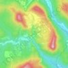
Corres topographic map

Click on the map to display elevation.

About this map

Name: Corres topographic map, elevation, terrain.

Location: Corres, Arraya-Maestu, Montaña Alavesa, Álava, País Vasco, 01128, España (42.67458 -2.48902 42.71758 -2.41638)

Average elevation: 752 m

Minimum elevation: 601 m

Maximum elevation: 1,040 m

Other topographic maps

Click on a map to view its topography, its elevation and its terrain.
Orbiso

España > País Vasco > Montaña Alavesa > Campezo

Average elevation: 637 m

Corres

España > País Vasco > Montaña Alavesa

Average elevation: 745 m

El Onzal

España > País Vasco > Montaña Alavesa > Campezo

Average elevation: 612 m

Onraita

España > País Vasco > Montaña Alavesa

Average elevation: 926 m

Maestu

España > País Vasco > Montaña Alavesa

Average elevation: 717 m

Bujanda

España > País Vasco > Montaña Alavesa > Campezo

Average elevation: 683 m

Gear up for your next adventure:

🏕️Camping Hammock - Integrated protection for sleeping between trees
🧥Packable Rain Jacket - Breathable waterproof layer for unpredictable weather
🗺️Topographic Maps - Detailed maps to explore trails, mountains, and wilderness areas
🧦Hiking Liner Socks - Thin base layer to prevent friction and blisters
🔭Compact Binoculars - Lightweight optics for scouting trails and wildlife

As an Amazon Associate, this site earns from qualifying purchases at no extra cost to you.