Geolocate

Raikal topographic map

Click on the map to display elevation.

About this map

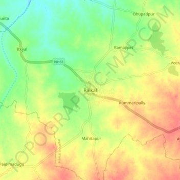
Name: Raikal topographic map, elevation, terrain.

Location: Raikal, Raikal mandal, Jagtial, Telangana, 505460, India (18.86479 78.76802 18.94479 78.84802)

Average elevation: 257 m

Minimum elevation: 229 m

Maximum elevation: 282 m

Gear up for your next adventure:

🧥Waterproof Pants - Keep dry during rainy hiking conditions
🧥Insulated Jacket - Keep warm in cold outdoor conditions
🐕Hiking Dog Pack - Let your canine companion carry their own water and food
🧊Insulated Water Bottle - Keeps drinks cold in summer and prevents freezing in winter
🥾Mountain Trail Shoes - High-traction shoes for mountain trails

As an Amazon Associate, this site earns from qualifying purchases at no extra cost to you.