Geolocate

Torriggia topographic map

Click on the map to display elevation.

About this map

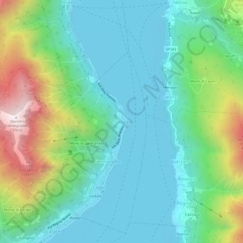
Name: Torriggia topographic map, elevation, terrain.

Location: Torriggia, Laglio, Como, Lombardy, 22010, Italy (45.87176 9.12332 45.91176 9.16332)

Average elevation: 500 m

Minimum elevation: 191 m

Maximum elevation: 1,359 m

Other topographic maps

Click on a map to view its topography, its elevation and its terrain.

Olgiate Comasco

Italy > Lombardy > Como

Average elevation: 393 m

Gear up for your next adventure:

🧶550 Survival Paracord - Versatile utility cord for emergency repairs and rigging
🎒Hiking Backpack - Lightweight and ergonomic backpacks for day hikes or multi-day treks
👟Trail Running Shoes - Agile footwear for fast-paced topographic exploration
🥾Hiking Leggings - Comfortable leggings for outdoor activities
🧥Insulated Jacket - Keep warm in cold outdoor conditions

As an Amazon Associate, this site earns from qualifying purchases at no extra cost to you.