Geolocate

Sugar Grove topographic map

Click on the map to display elevation.

About this map

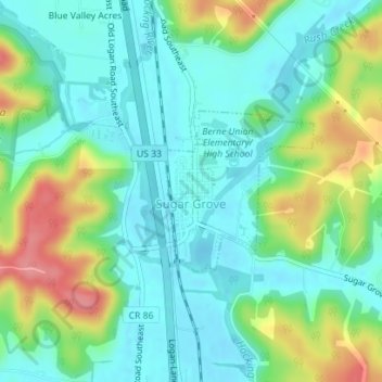
Name: Sugar Grove topographic map, elevation, terrain.

Location: Sugar Grove, Berne Township, Fairfield County, Ohio, United States (39.62164 -82.55097 39.63303 -82.53719)

Average elevation: 258 m

Minimum elevation: 229 m

Maximum elevation: 325 m

Other topographic maps

Click on a map to view its topography, its elevation and its terrain.

Walnut Creek

United States > Ohio > Fairfield County > Baltimore

Average elevation: 280 m

Geneva

United States > Ohio > Fairfield County

Average elevation: 276 m

Rising Park

United States > Ohio > Fairfield County > Lancaster

Average elevation: 274 m

Hooker

United States > Ohio > Fairfield County

Average elevation: 262 m

Lockville

United States > Ohio > Fairfield County > Lockville

Average elevation: 251 m

Whites

United States > Ohio > Fairfield County > Lancaster > Whites

Average elevation: 262 m

Poplar Creek

United States > Ohio > Fairfield County

Average elevation: 268 m

Gear up for your next adventure:

🥾Light Trekking Boots - Supportive boots for multi-day treks
🧥Softshell Jacket - Windproof and breathable jacket for hiking
👟Trail Running Shoes - Agile footwear for fast-paced topographic exploration
🛰️Satellite Messenger - Emergency communication for areas with no cell service
🥾Waterproof Hiking Boots - Essential footwear for rugged terrain and wet Canadian trails

As an Amazon Associate, this site earns from qualifying purchases at no extra cost to you.