Geolocate

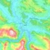
Devghat topographic map

Click on the map to display elevation.

About this map

Name: Devghat topographic map, elevation, terrain.

Location: Devghat, Tanahun, Gandaki Province, Nepal (27.74127 84.29240 27.88038 84.47180)

Average elevation: 603 m

Minimum elevation: 175 m

Maximum elevation: 1,590 m

Other topographic maps

Click on a map to view its topography, its elevation and its terrain.

Ramkot

Nepal > Gandaki Province > Tanahun

Average elevation: 736 m

Dumre

Nepal > Gandaki Province > Tanahun

Average elevation: 619 m

Vyas (Damauli)

Nepal > Gandaki Province > Tanahun

Average elevation: 501 m

Vyas (Damauli)

Nepal > Gandaki Province > Tanahun

Average elevation: 502 m

Bhimad

Nepal > Gandaki Province > Tanahun

Rangrung is famous for its altitude, accessing panoramic views of the broad Himalayan range. Hill Tower with telescope facilities will be constructed in the near future. This is popular for the resorts and overnight stayers. It has enormous potential for paragliding, this area is also famous for biodiversity.…

Average elevation: 544 m
Manungkot

Nepal > Gandaki Province > Tanahun

Average elevation: 652 m

Tharpu

Nepal > Gandaki Province > Tanahun

Average elevation: 603 m

Manungkot

Nepal > Gandaki Province > Tanahun

Average elevation: 652 m

Kotre

Nepal > Gandaki Province > Tanahun

Average elevation: 722 m

Khairenitar

Nepal > Gandaki Province > Tanahun

Average elevation: 724 m

Dumre

Nepal > Gandaki Province > Tanahun > Bandipur

Average elevation: 623 m

Gear up for your next adventure:

🥾Hiking Gaiters - Protect legs and shoes from mud, snow, and debris
🥾Hiking Boots - Sturdy boots providing ankle support and traction on rugged trails
🧢Outdoor Cap - Protective cap for sun and rain during hikes
🧴Outdoor Sunscreen - High SPF protection for high-altitude UV exposure
🥾Lightweight Hiking Shoes - Comfortable shoes for day hikes

As an Amazon Associate, this site earns from qualifying purchases at no extra cost to you.