
Thank you for supporting this site ❤️
Make a donation
Make a donation
Gear up for your next adventure:
As an Amazon Associate, this site earns from qualifying purchases at no extra cost to you.
Picoaza topographic map
Click on the map to display elevation.
Thank you for supporting this site ❤️
Make a donation
Make a donation
Gear up for your next adventure:
As an Amazon Associate, this site earns from qualifying purchases at no extra cost to you.
About this map
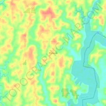
Name: Picoaza topographic map, elevation, terrain.
Location: Picoaza, Santa María, El Carmen, Manabí, Ecuador (-0.76575 -79.63210 -0.72575 -79.59210)
Average elevation: 98 m
Minimum elevation: 71 m
Maximum elevation: 127 m
Thank you for supporting this site ❤️
Make a donation
Make a donation
Gear up for your next adventure:
As an Amazon Associate, this site earns from qualifying purchases at no extra cost to you.