Geolocate

Azañón topographic map

Click on the map to display elevation.

About this map

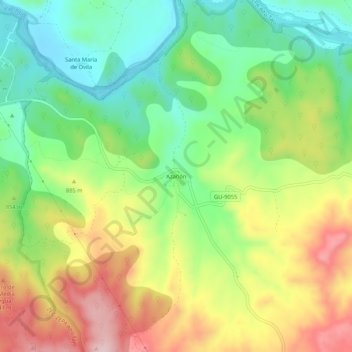
Name: Azañón topographic map, elevation, terrain.

Location: Azañón, Trillo, Guadalajara, Castilla-La Mancha, 19450, España (40.66690 -2.56448 40.70690 -2.52448)

Average elevation: 841 m

Minimum elevation: 729 m

Maximum elevation: 992 m

Gear up for your next adventure:

📷Outdoor Action Camera - Capture high-elevation views and rugged adventures
🥾Light Trekking Boots - Supportive boots for multi-day treks
Backpacking Tent - Lightweight tent for long-distance hiking trips
🧼Biodegradable Camp Soap - Environmentally friendly cleaning for gear and body
🩹Moleskin Blister Pads - Direct protection for painful foot pressure points

As an Amazon Associate, this site earns from qualifying purchases at no extra cost to you.