
Woody Lake topographic map
Interactive map
Click on the map to display elevation.
About this map
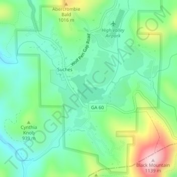
Name: Woody Lake topographic map, elevation, terrain.
Location: Woody Lake, Suches, Union County, Georgia, United States (34.68377 -84.02105 34.68827 -84.01463)
Average elevation: 889 m
Minimum elevation: 788 m
Maximum elevation: 1,125 m