Geolocate

Heredia topographic map

Click on the map to display elevation.

Heredia

Heredia has an area of 2.95 km² and an elevation of 1,150 metres.

About this map

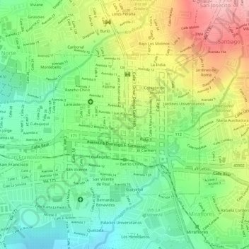
Name: Heredia topographic map, elevation, terrain.

Location: Heredia, Cantón Heredia, Heredia Province, 40101, Costa Rica (9.99082 -84.12495 10.00611 -84.10877)

Average elevation: 1,153 m

Minimum elevation: 1,079 m

Maximum elevation: 1,249 m

Gear up for your next adventure:

Backpacking Tent - Lightweight tent for long-distance hiking trips
🌬️Windproof Camp Stove - Efficient cooking even on exposed mountain peaks
Family Camping Tent - Spacious tent suitable for family camping trips
🧥Thermal Fleece Jacket - Versatile insulation for changing mountain temperatures
👖Convertible Hiking Pants - Zip-off legs to adapt to changing weather conditions

As an Amazon Associate, this site earns from qualifying purchases at no extra cost to you.