Geolocate

Kibalabag topographic map

Click on the map to display elevation.

About this map

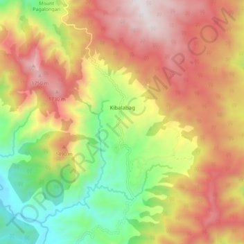
Name: Kibalabag topographic map, elevation, terrain.

Location: Kibalabag, Bukidnon, Northern Mindanao, Philippines (8.19820 125.12344 8.28261 125.20778)

Average elevation: 1,248 m

Minimum elevation: 609 m

Maximum elevation: 1,868 m

Gear up for your next adventure:

🚲Bike Repair Kit - Essential tools for on-trail mechanical issues
🔥Camping Stove - Portable stoves to cook outdoors with ease
🥾Approach Boots - Comfortable boots for hiking and climbing approaches
Camping Groundsheet - Protect your tent from moisture and dirt
🧢Outdoor Cap - Protective cap for sun and rain during hikes

As an Amazon Associate, this site earns from qualifying purchases at no extra cost to you.