
Thank you for supporting this site ❤️
Make a donation
Make a donation
Gear up for your next adventure:
As an Amazon Associate, this site earns from qualifying purchases at no extra cost to you.
Rugeley topographic map
Click on the map to display elevation.
Thank you for supporting this site ❤️
Make a donation
Make a donation
Gear up for your next adventure:
As an Amazon Associate, this site earns from qualifying purchases at no extra cost to you.
About this map
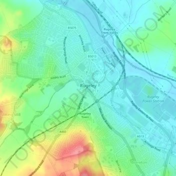
Name: Rugeley topographic map, elevation, terrain.
Location: Rugeley, Cannock Chase, Staffordshire, England, United Kingdom (52.74271 -1.96820 52.77418 -1.92549)
Average elevation: 90 m
Minimum elevation: 66 m
Maximum elevation: 149 m
Thank you for supporting this site ❤️
Make a donation
Make a donation
Gear up for your next adventure:
As an Amazon Associate, this site earns from qualifying purchases at no extra cost to you.