Geolocate

Rugeley topographic map

Click on the map to display elevation.

About this map

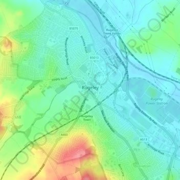
Name: Rugeley topographic map, elevation, terrain.

Location: Rugeley, Cannock Chase, Staffordshire, England, United Kingdom (52.74271 -1.96820 52.77418 -1.92549)

Average elevation: 90 m

Minimum elevation: 66 m

Maximum elevation: 149 m

Gear up for your next adventure:

🩹Moleskin Blister Pads - Direct protection for painful foot pressure points
🧤Thermal Hiking Gloves - Grip-enhanced gloves for cold-weather altitude trekking
🧥Waterproof Jacket - Lightweight rain jackets for hiking and outdoor activities
🥾Approach Boots - Comfortable boots for hiking and climbing approaches
🦶Anti-Blister Balm - Prevents friction and hotspots during long ascents

As an Amazon Associate, this site earns from qualifying purchases at no extra cost to you.