Geolocate

Limay topographic map

Click on the map to display elevation.

About this map
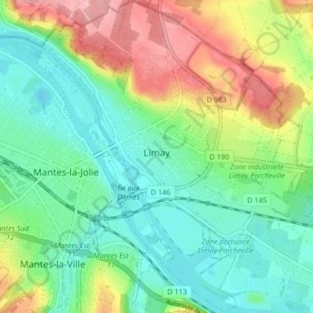
Name: Limay topographic map, elevation, terrain.

Location: Limay, Mantes-la-Jolie, Yvelines, Ile-de-France, Metropolitan France, 78520, France (48.96736 1.70838 49.01548 1.76484)

Average elevation: 57 m

Minimum elevation: 12 m

Maximum elevation: 140 m

Other topographic maps

Click on a map to view its topography, its elevation and its terrain.

Rodon

France > Ile-de-France > Yvelines

Average elevation: 167 m

Hautvilliers

France > Ile-de-France > Yvelines > Chevreuse

Average elevation: 127 m

La Corse

France > Ile-de-France > Yvelines > Élancourt

Average elevation: 165 m

Gear up for your next adventure:

👟Leg Gaiters - Keep debris, mud, and snow out of your boots
🥾Hiking Boots - Sturdy boots providing ankle support and traction on rugged trails
👟Sport Hiking Sandals - Breathable footwear for water crossings and camp rest
🛶Canoe Life Vest - Safety vest for water sports
⛺Tent Footprint - Protect tent floor and increase durability

As an Amazon Associate, this site earns from qualifying purchases at no extra cost to you.