
Thank you for supporting this site ❤️
Make a donation
Make a donation
Gear up for your next adventure:
As an Amazon Associate, this site earns from qualifying purchases at no extra cost to you.
Bunian topographic map
Click on the map to display elevation.
Thank you for supporting this site ❤️
Make a donation
Make a donation
Gear up for your next adventure:
As an Amazon Associate, this site earns from qualifying purchases at no extra cost to you.
About this map
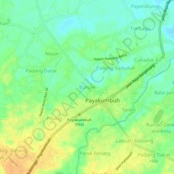
Name: Bunian topographic map, elevation, terrain.
Location: Bunian, Payakumbuh, West Sumatra, Sumatra, Indonesia (-0.24126 100.60841 -0.20126 100.64841)
Average elevation: 510 m
Minimum elevation: 495 m
Maximum elevation: 528 m
Thank you for supporting this site ❤️
Make a donation
Make a donation
Gear up for your next adventure:
As an Amazon Associate, this site earns from qualifying purchases at no extra cost to you.