Geolocate

Ambalite topographic map

Click on the map to display elevation.

About this map

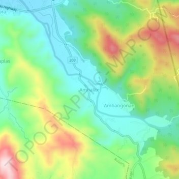
Name: Ambalite topographic map, elevation, terrain.

Location: Ambalite, La Union, Ilocos Region, 2508, Philippines (16.27959 120.45615 16.31959 120.49615)

Average elevation: 176 m

Minimum elevation: 53 m

Maximum elevation: 396 m

Gear up for your next adventure:

🥾Hiking Boots - Sturdy boots providing ankle support and traction on rugged trails
🧶550 Survival Paracord - Versatile utility cord for emergency repairs and rigging
👟Leg Gaiters - Keep debris, mud, and snow out of your boots
🔦LED Headlamp - Hands-free lighting for early morning starts or late finishes
🥾Light Trekking Boots - Supportive boots for multi-day treks

As an Amazon Associate, this site earns from qualifying purchases at no extra cost to you.