
Thank you for supporting this site ❤️
Make a donation
Make a donation
Gear up for your next adventure:
As an Amazon Associate, this site earns from qualifying purchases at no extra cost to you.
Tambo topographic map
Click on the map to display elevation.
Thank you for supporting this site ❤️
Make a donation
Make a donation
Gear up for your next adventure:
As an Amazon Associate, this site earns from qualifying purchases at no extra cost to you.
About this map
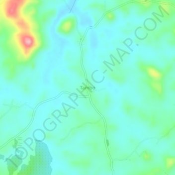
Name: Tambo topographic map, elevation, terrain.
Location: Tambo, Toabré, Distrito Penonomé, Coclé, Panamá (8.64554 -80.31598 8.68554 -80.27598)
Average elevation: 187 m
Minimum elevation: 157 m
Maximum elevation: 303 m
Thank you for supporting this site ❤️
Make a donation
Make a donation
Gear up for your next adventure:
As an Amazon Associate, this site earns from qualifying purchases at no extra cost to you.