
Thank you for supporting this site ❤️
Make a donation
Make a donation
Gear up for your next adventure:
As an Amazon Associate, this site earns from qualifying purchases at no extra cost to you.
Kota topographic map
Click on the map to display elevation.
Thank you for supporting this site ❤️
Make a donation
Make a donation
Gear up for your next adventure:
As an Amazon Associate, this site earns from qualifying purchases at no extra cost to you.
About this map
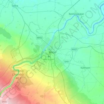
Name: Kota topographic map, elevation, terrain.
Location: Kota, Ladpura Tehsil, Kota District, Rajasthan, 324001, India (25.01370 75.69742 25.33370 76.01742)
Average elevation: 286 m
Minimum elevation: 228 m
Maximum elevation: 483 m
Thank you for supporting this site ❤️
Make a donation
Make a donation
Gear up for your next adventure:
As an Amazon Associate, this site earns from qualifying purchases at no extra cost to you.