Geolocate

Kota topographic map

Click on the map to display elevation.

About this map

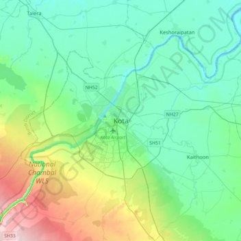
Name: Kota topographic map, elevation, terrain.

Location: Kota, Ladpura Tehsil, Kota District, Rajasthan, 324001, India (25.01370 75.69742 25.33370 76.01742)

Average elevation: 286 m

Minimum elevation: 228 m

Maximum elevation: 483 m

Gear up for your next adventure:

🩹Moleskin Blister Pads - Direct protection for painful foot pressure points
🌬️Windproof Camp Stove - Efficient cooking even on exposed mountain peaks
🧣Merino Neck Gaiter - Protects against wind, sun, and cold at high altitudes
🚲Bike Repair Kit - Essential tools for on-trail mechanical issues
Camping Coffee Maker - Brew fresh coffee anywhere on the topographic map

As an Amazon Associate, this site earns from qualifying purchases at no extra cost to you.