
Thank you for supporting this site ❤️
Make a donation
Make a donation
Gear up for your next adventure:
As an Amazon Associate, this site earns from qualifying purchases at no extra cost to you.
Chillanes topographic map
Click on the map to display elevation.
Thank you for supporting this site ❤️
Make a donation
Make a donation
Gear up for your next adventure:
As an Amazon Associate, this site earns from qualifying purchases at no extra cost to you.
About this map
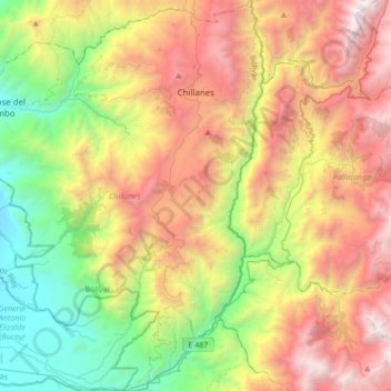
Name: Chillanes topographic map, elevation, terrain.
Location: Chillanes, Bolívar, 020201, Ecuador (-2.20312 -79.25752 -1.86360 -79.00671)
Average elevation: 1,656 m
Minimum elevation: 76 m
Maximum elevation: 3,741 m
Thank you for supporting this site ❤️
Make a donation
Make a donation
Gear up for your next adventure:
As an Amazon Associate, this site earns from qualifying purchases at no extra cost to you.