
Thank you for supporting this site ❤️
Make a donation
Make a donation
Gear up for your next adventure:
As an Amazon Associate, this site earns from qualifying purchases at no extra cost to you.
Pechuquiz topographic map
Click on the map to display elevation.
Thank you for supporting this site ❤️
Make a donation
Make a donation
Gear up for your next adventure:
As an Amazon Associate, this site earns from qualifying purchases at no extra cost to you.
About this map
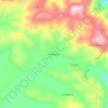
Name: Pechuquiz topographic map, elevation, terrain.
Location: Pechuquiz, Frías, Ayabaca, Piura, Perú (-4.94717 -79.83857 -4.90717 -79.79857)
Average elevation: 3,178 m
Minimum elevation: 2,940 m
Maximum elevation: 3,463 m
Thank you for supporting this site ❤️
Make a donation
Make a donation
Gear up for your next adventure:
As an Amazon Associate, this site earns from qualifying purchases at no extra cost to you.