
Alcorcón topographic map
Click on the map to display elevation.
Alcorcón
Durante el reinado de Felipe II (1556-1598) se publicaron las Relaciones Topográficas de Felipe II, una enciclopedia en la que se recogieron los datos topográficos e históricos de los pueblos de Castilla. En el capítulo II figura.
About this map
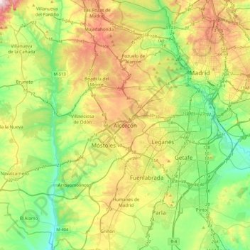
Name: Alcorcón topographic map, elevation, terrain.
Average elevation: 646 m
Minimum elevation: 535 m
Maximum elevation: 839 m
Other topographic maps
Click on a map to view its topography, its elevation and its terrain.