Geolocate

Braselton topographic map

Click on the map to display elevation.

About this map

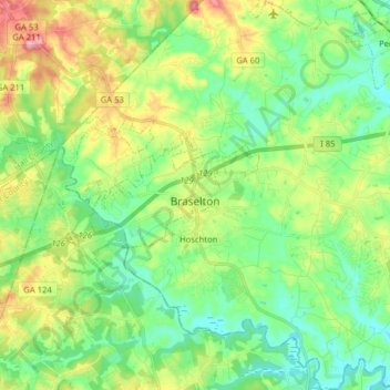
Name: Braselton topographic map, elevation, terrain.

Location: Braselton, Jackson County, Georgia, United States (34.08496 -83.89479 34.13798 -83.73676)

Average elevation: 268 m

Minimum elevation: 218 m

Maximum elevation: 371 m

Gear up for your next adventure:

🧢Sun Protection Cap - Breathable cap to protect from sun exposure
Camping Groundsheet - Protect your tent from moisture and dirt
🥾Waterproof Hiking Boots - Boots keeping your feet dry in wet conditions
🎒Hiking Daypack - Lightweight and durable backpacks for day trips and excursions
🥾Trail Running Shoes - Lightweight and durable shoes for trail running

As an Amazon Associate, this site earns from qualifying purchases at no extra cost to you.