
Una topographic map
Interactive map
Click on the map to display elevation.
About this map
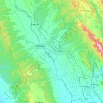
Name: Una topographic map, elevation, terrain.
Location: Una, Himachal Pradesh, Inde (31.34048 76.07557 31.58868 76.37323)
Average elevation: 448 m
Minimum elevation: 319 m
Maximum elevation: 1,035 m