
Puyuhuapi topographic map
Click on the map to display elevation.
About this map
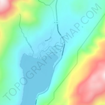
Name: Puyuhuapi topographic map, elevation, terrain.
Average elevation: 229 m
Minimum elevation: -2 m
Maximum elevation: 852 m
Other topographic maps
Click on a map to view its topography, its elevation and its terrain.
Isla Florencia
Chile > Aysen del General Carlos Ibanez del Campo Region > Provincia de Aysén > Cisnes
Average elevation: 13 m
Isla Florencia
Chile > Aysen del General Carlos Ibanez del Campo Region > Provincia de Aysén > Cisnes
Average elevation: 13 m