Geolocate

Qili topographic map

Click on the map to display elevation.

About this map

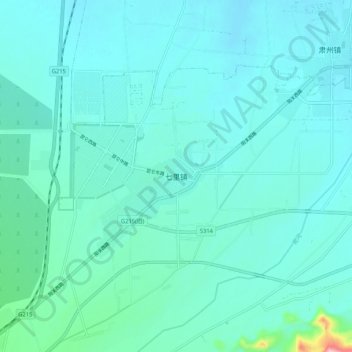
Name: Qili topographic map, elevation, terrain.

Location: Qili, Dunhuang City, Jiuquan, Gansu, 736200, China (40.07534 94.55697 40.15534 94.63697)

Average elevation: 1,164 m

Minimum elevation: 1,137 m

Maximum elevation: 1,369 m

Other topographic maps

Click on a map to view its topography, its elevation and its terrain.

Shazhou

China > Gansu > Dunhuang City

Average elevation: 1,142 m

洋水海子

China > Gansu > Dunhuang City

Average elevation: 1,023 m

Gear up for your next adventure:

💧Hydration Pack - Hands-free hydration system for long hikes
Lightweight Backpacking Tent - Compact tent for efficient hiking trips
🧰Survival Kit - Essential gear for emergencies in the wilderness
🔭Outdoor Binoculars - Lightweight binoculars for birdwatching and hiking
🧢Outdoor Cap - Protective cap for sun and rain during hikes

As an Amazon Associate, this site earns from qualifying purchases at no extra cost to you.