Geolocate

Nostitz topographic map

Click on the map to display elevation.

About this map

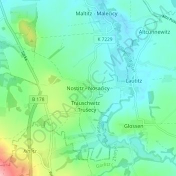
Name: Nostitz topographic map, elevation, terrain.

Location: Nostitz, Weißenberg, Bautzen, Sachsen, Deutschland (51.14479 14.65537 51.18479 14.69537)

Average elevation: 210 m

Minimum elevation: 178 m

Maximum elevation: 317 m

Gear up for your next adventure:

🧴Insect Repellent - Protect yourself from bugs during outdoor adventures
🔦LED Flashlight - Powerful and long-lasting flashlight for camping and emergencies
💧Reusable Water Bottle - Durable water bottles for hydration on trails
🥾Trail Hiking Socks - Comfortable socks to prevent blisters and fatigue
👟Sport Hiking Sandals - Breathable footwear for water crossings and camp rest

As an Amazon Associate, this site earns from qualifying purchases at no extra cost to you.