Geolocate

Villar topographic map

Click on the map to display elevation.

About this map

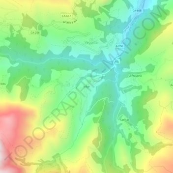
Name: Villar topographic map, elevation, terrain.

Location: Villar, Veguilla, Soba, Cantabria, 39210, España (43.15763 -3.54481 43.19763 -3.50481)

Average elevation: 476 m

Minimum elevation: 183 m

Maximum elevation: 977 m

Gear up for your next adventure:

🔪Outdoor Multitool - Versatile tool for repairs and food prep in the wild
🐕Hiking Dog Pack - Let your canine companion carry their own water and food
🦶Hiking Shoe Insoles - Added support for high arches and long days on feet
🧢Beanie Hat - Keep your head warm in cold weather
🧴First Aid Kit - Essential first aid supplies for outdoor emergencies

As an Amazon Associate, this site earns from qualifying purchases at no extra cost to you.