Geolocate

Sprucedale topographic map

Click on the map to display elevation.

About this map

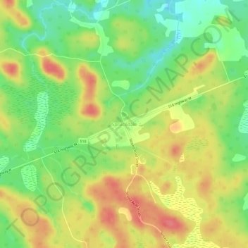
Name: Sprucedale topographic map, elevation, terrain.

Location: Sprucedale, McMurrich/Monteith Township, Parry Sound District, Central Ontario, Ontario, Canada (45.46981 -79.48340 45.50981 -79.44340)

Average elevation: 330 m

Minimum elevation: 296 m

Maximum elevation: 363 m

Other topographic maps

Click on a map to view its topography, its elevation and its terrain.

Gear up for your next adventure:

🧰Multitool Knife - Compact and versatile tool for outdoor use
🛌Insulated Sleeping Pad - Critical thermal barrier between you and the cold ground
🧤Insulated Winter Gloves - Heavy-duty protection for sub-zero Canadian adventures
🛌Down Sleeping Bag - Superior warmth-to-weight ratio for cold nights
🏕️Camping Hammock - Integrated protection for sleeping between trees

As an Amazon Associate, this site earns from qualifying purchases at no extra cost to you.