Geolocate

Nightcaps topographic map

Click on the map to display elevation.

About this map

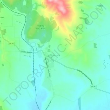
Name: Nightcaps topographic map, elevation, terrain.

Location: Nightcaps, Wallace Takitimu Community, Southland District, Southland, 9630, New Zealand (-45.98974 168.01567 -45.94974 168.05567)

Average elevation: 183 m

Minimum elevation: 135 m

Maximum elevation: 324 m

Other topographic maps

Click on a map to view its topography, its elevation and its terrain.

Gear up for your next adventure:

Lightweight Camping Tent - Portable shelter optimized for Canadian backcountry camping
💡Compact LED Flashlight - Powerful and portable flashlight for outdoor use
🥫Freeze-Dried Meals - Lightweight, high-calorie nutrition for multi-day treks
🥾Durable Hiking Shoes - Long-lasting shoes for frequent hiking
🔦LED Headlamp - Hands-free lighting for early morning starts or late finishes

As an Amazon Associate, this site earns from qualifying purchases at no extra cost to you.