Geolocate

Huntsville topographic map

Click on the map to display elevation.

About this map

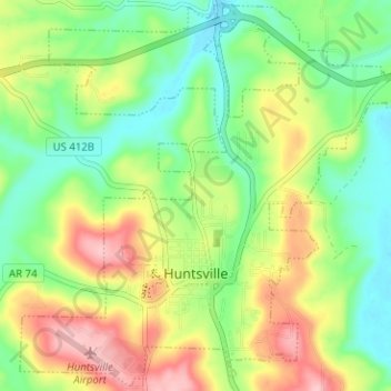
Name: Huntsville topographic map, elevation, terrain.

Location: Huntsville, Madison County, Arkansas, United States (36.07379 -93.76596 36.12348 -93.70290)

Average elevation: 442 m

Minimum elevation: 380 m

Maximum elevation: 534 m

Other topographic maps

Click on a map to view its topography, its elevation and its terrain.

Yates Mountain

United States > Arkansas > Madison County

Average elevation: 476 m

Gear up for your next adventure:

🥾Trekking Poles - Adjustable trekking poles to reduce knee stress and improve stability
🧥Insulated Jacket - Keep warm in cold outdoor conditions
🥾Trail Hiking Socks - Comfortable socks to prevent blisters and fatigue
🥾Hiking Leggings - Comfortable leggings for outdoor activities
🔦UV Flashlight - Detect minerals or specific insects in the dark

As an Amazon Associate, this site earns from qualifying purchases at no extra cost to you.